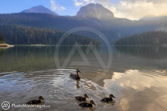
Durmitor is a mountain and the name of a national park in Montenegro. It reaches a height of 2,522 meters (Bobotov Kuk).
Name Durmitor is probably derived from Balkan Romance (some Romanian/Vlach dialect), and it means “sleeping” (cognate with English dormitory). There are similarly named mountains such as Visitor (< visător, "dreaming") and Cipitor (< aţipitor, "sleeping") across ex-Yugoslavia. Another etymology could be from Celtic meaning "mountain with water"
The Durmitor National Park, created in 1952, includes the massif of Durmitor, the canyons of Tara, Sušica and Draga rivers and the higher part of the canyon plateau Komarnica, covering the area of 390 km².
It was inscribed on the World Heritage List in 1980. There are beatuifull landscapes and unique nature.
A part of the National park Durmitor is also the Tara River Canyon, 80 km long and 1,300 m deep, second largest in the world, just behind Grand Canyon in Arizona.
Durmitor mountain is the centre of Montenegrin mountain tourism. The tourist facilities are concentrated around the town of Žabljak.
During the winter, main activities on Durmitor are skiing and, increasingly, snowboarding. In the summer, the activities shift to mountaineering and recreational tourism. One of the most prominent attraction of Durmitor mountain are 18 glacial lakes, best known being Crno Lake.
The area and the mountain was the location of the Battle of the Sutjeska in 1943 in World War II, when the Germans and Italians pursued Tito’s Partisans. There is a monument commemorating the battle in Tjentište.
Wikipedia Article
01) Bobotov Kuk (2523m)
02) Bezimeni Vrh (2487m)
03) Šljeme (2455m)
04) Istocni Vrh (2445 m)
05) Đevojka (2440m)
06) Milosev Tok (2426m)
07) Bandijerna (2409m)
08) Rbatina (2401m)
09) Lučin Vrh (2396m)
10) Prutaš (2393m)
11) Minin Bogaz (2387m)
12) Planinica (2330m)
13) Kobilja Glava (2321m)
14) Savin Kuk (2313m)
15) Šupljika (2310m)
16) Zupci (2309m)
17) Obla Glava (2303m)
18) Terzin Bogaz (2303m)
19) Gruda (2302m)
20) Međed (2287m)
21) Suva Rtina (2284m)
22) V.Previja (2255)
23) Stit (2248m)
24) Vjetrna Brda (2231m)
25) Sedlena Greda (2227m)
01) Crno Jezero (1416m) (49m)
02) Veliko Škrčko Jezero (1686m) (17.2m)
03) Malo Škrčko Jezero (1711m) (15.2m)
04) Zeleni Vir (2028m) (2.5m)
05) Jablan Jezero (1791m) (8.5m)
06) Valovito jezero (1695m) (3.5m)
07) Vir u Lokvicama (1693m) (4m)
08) Srablje Jezero (1623m) (2.5m)
09) Modro Jezero (1609m) (3.3m)
10) Suva Lokva (1593m) (2.5m)
11) Zminje Jezero (1520m) (7.7m)
12) Barno Jezero (1489m) (2m)
13) Pošćensko Jezero (1487) (3.6m)
14) Zabojsko Jezero (1477m) (18.8m)
15) Vražje Jezero (1411m) (10.6m)
16) Riblje Jezero (1409m) (5.5m)
17) Zminičko Jezero (1285m) (3.8m)
18) Sušićko Jezero (1150m) (5m)
/li


